Recent articles
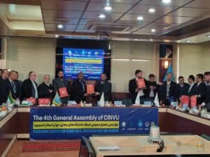
Gabon in the Spotlight: UNIVGA Re-elected to the Executive Board of CINVU
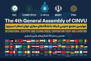
The Fourth General Assembly of CINVU

Partnership between UNIVGA GROUP and MIT Nabeul
 Certificate
Professional Certificate in Business Intelligence with Excel and Power BI
Description of the GIS Expert Profession:
A Geographic Information Systems (GIS) expert is a professional specialized in the management, analysis, and visualization of geospatial data. GIS combines geographic data with attribute information to enable advanced spatial analysis. The responsibilities of a GIS expert include:
- Geospatial data collection : Gathering data from various sources, such as satellites, sensors, field surveys, etc.
- Spatial analysis : Using GIS tools to perform advanced spatial analyses, such as mapping, spatial modeling, and network analysis.
- Development of geospatial databases : Designing and managing databases that store geographic data for efficient use in GIS.
- Mapping and visualization : Creating maps and visualizations that help communicate geospatial information clearly and understandably.
- Integration of technologies : Integrating technologies such as Global Positioning Systems (GPS) to enhance the accuracy of geospatial data.
- Consulting and training : Providing advice to organizations on how to effectively use GIS, as well as training users on the use of GIS tools.
Opportunities for GIS Experts:
GIS experts can work in various environments, including:
- Governments and public agencies : Working on land management projects, urban planning, natural resource management, and other government initiatives.
- Private companies : Contributing to projects related to location, logistics, market analysis, and other business applications.
- Non-governmental organizations (NGOs) : Participating in projects related to participatory mapping, disaster management, environmental monitoring, etc.
- Research : Working in research institutions to develop new GIS methods and technologies or participate in geospatial research projects.
- Consulting : Providing GIS consulting services to various organizations, helping them develop and implement geospatial solutions.
Advantages of the GIS Expert Profession:
- Significant impact : Contributing to solving real-world problems by using geospatial data to make informed decisions.
- Diversity of projects : Work on a variety of projects, from natural resource management to urban planning, offering a stimulating diversity.
- Technological evolution : Stay at the forefront of technology by working with advanced GIS tools and participating in the development of new geospatial applications.
- Interdisciplinary collaboration : Work with professionals from various fields, from the environment to public health, using GIS as an interdisciplinary tool.
- Growing demand : With the growth of geospatial data collection, the demand for GIS experts is constantly increasing.
In summary, the profession of Geographic Information Systems Expert offers exciting opportunities for those interested in spatial analysis and geographic data visualization. These professionals play a crucial role in decision-making based on accurate geospatial data and contribute to areas ranging from urban planning to natural resource management.




 French
  English