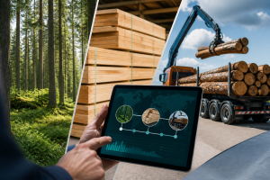
An example from Colorado sheds light on land digitization: registering landmarks online can reduce disputes, if the evidence remains controlled. Imagine a town hall wanting to reduce conflicts between neighbors. The plans exist, but they are stored in several offices, sometimes scanned, sometimes handwritten. One agent finds an old marker on a plan, another consults a different map. The…
The Editorial of the UNIVGA Review ·
Imagine a town hall wanting to reduce conflicts between neighbors. The plans exist, but they are stored in several offices, sometimes scanned, sometimes handwritten. One agent finds an old marker on a plan, another consults a different map. The subdivision project is delayed.
Now imagine a university training its students to verify a plot on a digital map before any development. The progress seems simple. Yet, one question decides everything: does the digital data truly prove the boundary of the land?
A land marker is a physical point used to establish a land boundary: boundary stone, mark, reference point, or survey monument. Colorado's reform requires professional surveyors to submit certain files of these markers in electronic format, then allows local registration services to also keep them in digital form. The mechanism resembles the transition from paper accounting to reliable software: each piece of evidence becomes easier to locate, classify, and control. The main issue is not IT, but land security. A poorly established boundary can block a construction site, a tax, or a title. Well organized, digital technology assists without replacing the professional.
Concrete case: what to do and what not to do
Questions to Ask Before Acting
Does the digital document have the same administrative value as the paper document?
Who validates the position of a cadastral point: software, an agent, or a licensed surveyor?
Do the data indicate their source, date, precision, and responsible party?
Can the complete history of a plot be easily retrieved?
Do the services of the cadastre, urban planning, taxation, and land conservation use the same data language?
Can citizens track their files without exposing sensitive information?
In case of an error, is there a correction, audit, and appeal procedure?
By clicking on "Accept All", you authorize the placement of cookies to facilitate navigation, measure audience, and provide you with information about our training programs. Privacy policy
UNIVGA Group
Set cookies
Necessary cookies remain active. Other categories are optional. Learn more
NecessarySession, security, connection.
PreferencesLanguage and display.
AudienceVisitor statistics.
ProspectingInformation about our training programs.
We detected that you may prefer English. Would you like to switch?



 Certificate




 French
  English